Available on
 PC
PC Mobile device
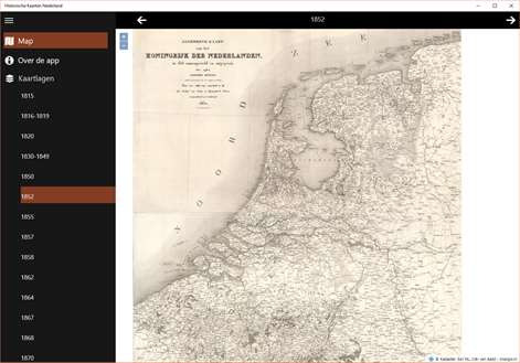

Information
License:Free
Category:Navigation & maps
User-rating:5.0 ( 3 Reviews )
Publisher:Mapdev
Language supported:
Nederlands (Nederland) English (United States)
Minimum
OS:Windows 10, Windows 10 Mobile
Architecture:ARM, x86, x64
Recommended
OS:Windows 10, Windows 10 Mobile
Architecture:ARM, x86, x64
Description
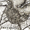
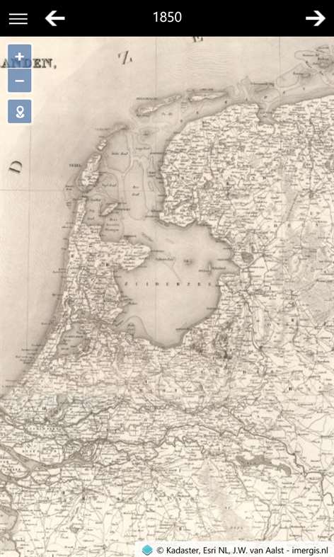
The historical maps Netherlands app contains old maps from 1815 until 2015. The app contains maps from the following sources at different scale levels: Small scale: Post route map 1810, General Map of the Netherlands and municipality map Small/medium scale: Kraijenhoff map Medium scale: Military Topographic Map, RD050 (1:50.000) Large scale: Bonnebladen en RD025 (1:25.000)
Maps can be shared or saved as image.
The GPS is used to zoom to your current location in the Netherlands. GPS functionality. will be disabled when your device is located outside the Netherlands.
Show More
Download Historische Kaarten Nederland
( 3 Reviews )
People also like
Reviews
-
4/14/2016Great app by Mark
Very nice maps of the history of the Netherlands.
-
4/14/2016Nice and quick viewer by Paul
Good looking, easy-to-use viewer of historical maps of the Netherlands!
Articles
About Historische Kaarten Nederland
Top downloads
- 1
Windows Maps
Free
- 2
gMaps
Free
- 3
GPS Satellite
Free
- 4
MapQuest
Free
- 5
GPS Voice Navigation
Free


New and rising apps
- 1
Stars 3D
$1.49
- 2
NAVIGON Europe
$80.49
- 3
Paris ci la Sortie
$0.99
- 4
SeaMap
$0.99
- 5
Outdoor Navigation
$4.99
- 6
Amsterdam Metro
$0.99
- 7
Altimetro
$0.99
- 8
FirstMate
$4.99
- 9
Bicing Barcelona
$1.49
- 10
City Maps - Vienna
$0.99


Best-rated apps
- 1
Transit Indianapolis
$1.99
- 2
myLocation
$0.99
- 3
Reitit
Free
- 4
Street Views
Free
- 5
MyLocation
Free
- 6
SatelliteMap
$4.99
- 7
Compass
Free
- 8
Geo Converter (Lite)
Free
- 9
Photo Editor India
Free
- 10
Road Trips
Free


Best-rated games
- 1
Sudoku Play & Solve
$0.99
- 2
BoxEmoji
Free
- 3
Drift Mania Championship
$0.99
- 4
Ball don't fall
$1.99
- 5
Hidden Object : Film Ready Action
$1.99
- 6
2 Pics 1 Word - Free
Free
- 7
Hidden Object : Hollywood Crime
$1.99
- 8
Nuclear Warfare
Free
- 9
Funtoon's World HD
Free
- 10
Debonair
Free